Dr. Sarah Treanor Bois
Director of Research & Education at the Linda Loring Nature Foundation
We’ve all heard of them. Many of us on Nantucket have seen them hovering over our coastlines and possibly in our backyards. And then there is that buzzing sound. We’re talking about drones.
The Nantucket Pond Coalition, the Nantucket Land Council, and the Linda Loring Nature Foundation teamed up in 2016 with off-island consultant, Ron Fortunato of Trillium Learning, to use drone technology to map non-native invasive plants on some of Nantucket’s major ponds. Researchers from the University of Massachusetts Amherst also helped with mission planning and technical assistance for this project. This was a first for Nantucket collaboration, opening the door for a multitude of scientific applications.
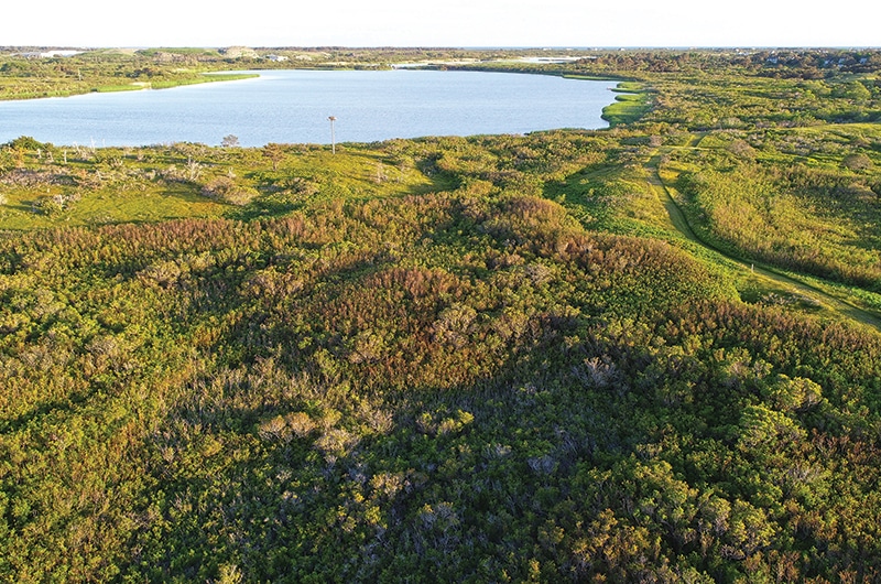
Surveys were conducted over two days in November of 2016, covering Long Pond, Hummock Pond, and Miacomet Pond. These surveys were targeted at mapping the non-native invasive Phragmites australis (Giant Reed). Because Phragmites causes large monoculture stands along pond edges, this system is a good test of the resolution of the drone technology and imaging.
When flying for ecological purposes, the drone needs to fly along a precise, preprogrammed route. To conduct the surveys, the drone is programmed to fly over the pond edges taking a picture every few seconds.
At the end of all the flights is when the magic really happens and postprocessing begins. The individual photos are seamlessly meshed together using computer software to create a high definition image of the pond. This image is georeferenced and is ready to use in any GIS software.
The tech is ideal for ecological surveys as the starting and ending points of survey transects as well as the altitude can be programmed into the drone. This makes for systematic and constant surveys throughout.
Based on the image results from these surveys, the differences in vegetation are clearly visible and the Phragmites stands can be easily distinguished. The drone surveys saved the Nantucket Pond Coalition a considerable amount of money, time, and effort in surveying the pond edges. If done with more traditional methods, a field person would use a hand-held GPS device to walk the perimeter of each Phragmites stand. Generally, that would take several, 8-hour days per pond, plus the need to use a boat for the pondside of the surveys. In contrast, all three ponds, Long, Hummock, and Miacomet, were able to be surveyed by drone in a day-and-a-half.
The data collected will be used to calculate the total area and volume of Phragmites for each pond. These images are also being used as a baseline to compare with future surveys in order to document expansion of populations and the results of possible management.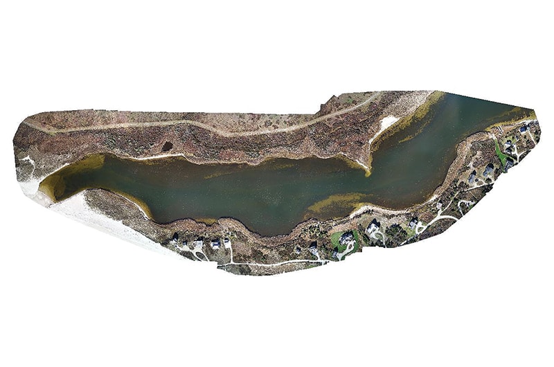
If you are interested in flying drones, check out the Federal Aviation Administration (FAA) webpage: it has most everything you need to know about operating drones for recreational or business purposes: www.faa.gov/uas/getting_started. The B4UFLY mobile App helps determine if there are any restrictions or requirements at the location where they want to fly. If you want to fly drones for business, research, or any other non-recreational reason, you MUST receive authorization under Part 107 of the Small UAS Rule.
On Nantucket, almost the entire island’s airspace is controlled by the Nantucket Memorial Airport. In order to fly a drone for any reason within the controlled airspace, you must seek permission from the Federal Aviation Administration Tower.
See you in the sky!