~ by Amy Jenness ~

In mid-September of 1961 Hurricane Esther gathered itself into a category three, and the category four, hurricane as it moved north-northwest from the Cape Verde Islands. The storm peaked with sustained winds of 145 mph, made landfall in North Carolina and continued north. Early on September 26 Esther struck Nantucket and Cape Cod. Although storm-related damage was considered minor, strong winds caused over 300,000 power outages in New York State and seven people died when a United States Navy airplane crashed north of Bermuda.
Although Hurricane Esther was not considered a major storm on the Atlantic coast, its impact on Nantucket would last more than 20 years.
Esther pushed 20 foot waves onshore in Madaket, which plowed through Broad Creek Crossing and cut Smith’s Point off from the rest of Nantucket. In the days following, islanders assumed the channel would close in and Smith’s Point would reconnect, but it did not.
With a wide opening to the sea established, strong ocean currents continued to redefine Madaket’s shoreline throughout the fall. By November three homeowners had moved their cottages away from the eroding shoreline. The severed section of Smith’s Point remained an island for more than 20 years and eventually became known as Esther’s Island. In the mid1980s shifting sands reconnected Esther’s Island to Nantucket. Hurricane Esther had other historical implications. It was the first large tropical cyclone discovered using satellite imagery, and Esther was one of the US Navy’s first targets in an experiment intended to weaken hurricanes by seeding them.
On September 16, 1961, a US Navy plane flew into the eye of Esther when it was positioned 400 miles northeast of Puerto Rico. Pilots dropped canisters of silver iodide into the eye of the storm and observed that the hurricane appeared to weaken by about ten percent. The impact was short-lived, however, and Esther began to gather strength again the next day. The pilots returned to seed again, but those canisters fell outside their target and had no effect.
Despite the second failure, the US Navy called the experiment a success and established Project Stormfury, which the US Government operated from 1962 to 1983.
The project’s scientists speculated that the silver iodide would cause water contained within the storm clouds to freeze and disrupt the inner structure of the hurricane. After Hurricane Esther, scientists seeded several Atlantic hurricanes and discovered their theory was not correct because most hurricanes do not contain enough cooled water for cloud seeding to be effective.
The last experimental seeding flight occurred in 1971 and the project ended because a lack of suitable storms and changes at NOAA. Project leaders had hoped to shift Stormfury to the Pacific coast, which received more tropical storms with the criteria needed to test their seeding hypothesis. But the seeding portion of the experiments ended due to political pressure from both the US Congress and other countries, including Cuban president Fidel Castro who accused the United States of attempting to turn storms into destructive weapons.
For the next 12 years, Stormfury pilots flew into hurricanes and tropical storms to gather information. In the end, Project Stormfury’s largest contribution to meteorology was providing scientists with data that helped NOAA improve its ability to predict the course and intensity of future hurricanes. Despite Stormfury’s end, NOAA still maintains a Hurricane Research Division. The National Weather Bureau designates Atlantic hurricane season to last from June 1 to November 30. On Nantucket, the worst hurricanes to hit have occurred between late August and October.

In 1938, the New England Hurricane evolved from a category 3 into a category 5 storm before landing in New England. The Blue Hill Observatory registered a peak wind gust of 186 mph before its wind tracking instruments broke. The storm killed over 600 people and is considered to be the worst hurricane to strike New England in modern times.
Hurricane Donna landed at Nantucket and the region one year before Esther in 1960. Donna recorded a peak wind gust of 110 mph at New Bedford Airport. The storm caused heavy tree, utility, and structural damage in southeastern Massachusetts, coastal New Hampshire, and Maine.
Hurricane Bob approached the island in late August 1991. Bob was one of the smallest storms in area size, yet was one of the most intense to hit southern New England since 1938. Bob brought a tidal surge that was 10 feet above normal and several Cape Cod weather watchers reported unofficial gusts of 150 mph.
Two months later, on October 30, the most destructive storm ever to hit Nantucket landed. It has no official name, but has been called the “No Name Storm” and “The Perfect Storm.” It began as a nor’easter and evolved into a hurricane.
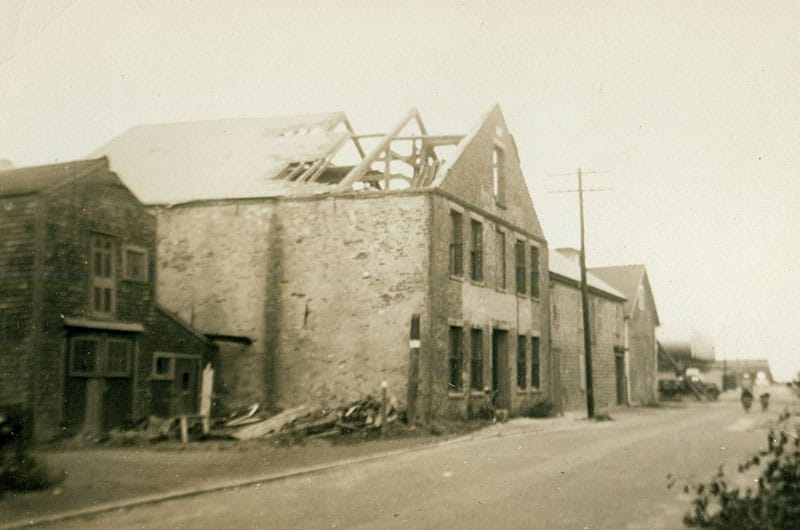
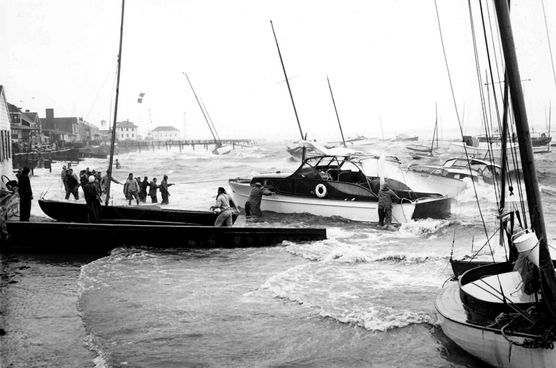
On Nantucket, high winds and seas battered the shoreline and caused up to $30 million in damage. Waterfront wharves and buildings were destroyed and boats sank or came to rest in yards and parking lots. The flooding went deeper into the island’s interior than anyone had ever seen.
Storm waters split a portion Great Point off from the rest of the island and created an island of it for five months. At one point the gap between Great Point and Nantucket was a quarter mile wide and six feet deep. Shifting sands eventually filled it and reconnected it to the island.
Amy Jenness is the author of On This Day In Nantucket History.


